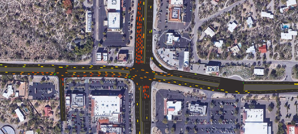
Transportation planning and land use go hand in hand and can influence one another. In its transportation modeling work to identify transportation solutions, Pima Association of Governments considers land use patterns and various activities, such as commercial or residential development, that influence land use.
Through predictive modeling, PAG aims to help regional partners make better decisions on what investments are needed, and where, to meet transportation goals as well as air quality regulations. PAG uses multiple sources of data to create modeling technology to test potential ideas and predict future regional needs.
In one scenario, a local jurisdiction plans to offer economic incentives to large employers to create a business and economic hub, ultimately generating economic stimulus to the immediate area and the region.
To complete the planning for this scenario, modeling would consider where potential employees live, how many are hybrid workers, what access the hub needs to the interstate system and the volume of traffic on existing or new roads, for example. Modeling for transportation needs of the employees, products and services in the employment hub rounds out the picture.
PAG’s transportation planning activities rely on modeling to ensure plans meet future needs as closely as possible and allow for adjustments along the way to refine the implementation of transportation solutions.
Activity-based modeling
PAG’s activity-based model aims to better represent changing travel options and behaviors to inform its regional transportation planning.
The advanced, simulating model technology focuses on travel demand and provides greater analytical details for modelers to have a clearer understanding of daily travel patterns of individuals and households, such as departure times.
The activity-based model also can forecast new mobility impacts, such as connected and autonomous vehicles, ridesharing and home delivery services generated through e-commerce.
By aligning its modeling efforts with those of Maricopa Association of Governments, the metropolitan planning organization in Phoenix, PAG will help make it easier to embark on managing growth and planning for future needs in the Sun Corridor megaregion, which includes the metropolitan areas of Phoenix, Tucson, Prescott, Nogales and Sierra Vista-Douglas.
Besides using household survey data, anonymized cell phone data, population projections and a representative employer database, the activity-based model uses geographic inputs such as information about the local jurisdictions, as well as Interstates 10 and 19.
Information on how roadways are configured and data from existing traffic signal management systems is used to help assess traffic congestion or the efficiency of a travel corridor to help determine potential solutions.

